 Oud-Beijerland





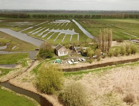
Het prachtige landschap van de Hoeksche Waard(The beautiful landscape of the Hoeksche Waard)
Cycle route of 48.1 km.
Interactive route map
Download GPX ↓View the route on the map
Kaartgegevens © OpenStreetMap-bijdragers. De routegeometrie komt uit het lokaal opgeslagen GPX-bestand van de bron.
You cycle through a mosaic of dikes, creeks and vast meadows. Wave out under the high skies and enjoy the silence.From junction 31 you look left over the Saint Anthonypolder dating from 1357. It's the only polder in the Hoeksche Waard which did not flood during the notorious Saint Elizabeth's flood of 1421. Strijen is one of the oldest places in the Hoeksche Waard. You will see beautiful houses and farms, but also the fifteenth-century St.Lambertus church. Further on you pass the marina of Numansdorp,
Would you like to view the current source page, route map or additional information?
View the original page at Visit Hoeksche Waard ↗