 Oud-Beijerland





Wandelroute Zuiderwaterlinie(Hiking route Zuiderwaterline)
Hiking trail of 6.9 km.
View the route on the map
Kaartgegevens © OpenStreetMap-bijdragers. De routegeometrie komt uit het lokaal opgeslagen GPX-bestand van de bron.
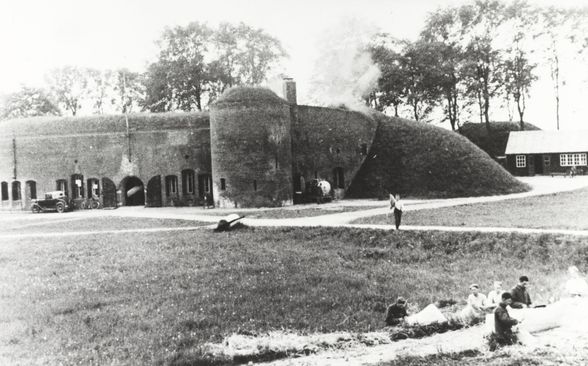
Through the southern Netherlands runs the Zuiderwaterline, the oldest, longest and most used waterline in the Netherlands.An ingenious defense system of fortified cities, fortresses, ramps, dikes and locks, designed in the seventeenth century by Menno van Coehoorn.The Theorem of Willemstad had for hundreds of years the task to defend the sea arms that offered access to Holland. Around Willemstad are five forts, an open circle on the water.Fort Buitenluis is one of them. Fort Buitenluis and the surrounding cultural landscape together form a true heritage pearl. This walk is an exploration of nature, history and culture around the fortress.
.Dogs are not allowed on part of the route.
Route owner: Municipality Hoeksche Waard and Alliance Southern Waterline
Would you like to view the current source page, route map or additional information?
View the original page at Visit Hoeksche Waard ↗