 Oud-Beijerland





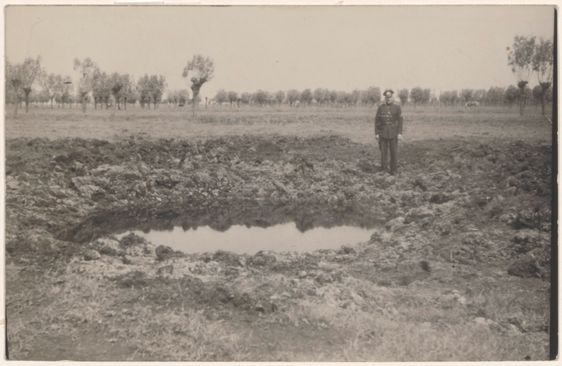
Numansgors - Bomkraters(Numansgors - Bomb craters)
Numansgors 203 3281 HA Numansdorp
Location
View on the map
Map data © OpenStreetMap contributors. The location coordinates are stored from the source page.
The district of Numansgors is located on foreign grounds, which were hit during bombings and artillery shootings during World War II.This is evident from several reports and historical aerial photos showing bomb craters. Numansgors was originally a holiday park with 200 recreational homes.The houses on the Numansgors were designed in the late seventies of the last century by order of the then "Sporthuis Centrum." In 2013 permanent residence is permitted at the Numansgors.With this it has officially become a district of Numansdorp.
Would you like to view the current source page, map or additional information?
View the original article at Visit Hoeksche Waard ↗