 Oud-Beijerland





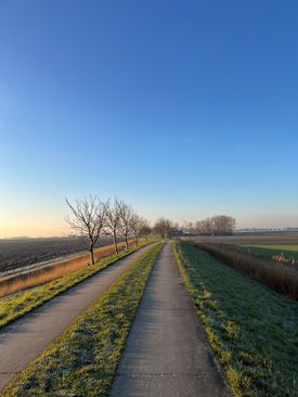
Karrenspoor(Trailer)
Oude Nieuwlandsedijk 7 3267 LP Goudswaard
Location
View on the map
Map data © OpenStreetMap contributors. The location coordinates are stored from the source page.
The Oude Nieuwlandsedijk is part of the old polder landscape created by the inpolderings in the 16th century.Although the Oude Nieuwlandsedijk is historically closely linked to the polder area around Piershil, the addresses of the Oude Nieuwlandsedijk cadastral lie in the residence of Goudswaard.In the past these addresses were accessible via a gravel road. It is now an asphalt road, but beyond the house at number 7 this road passes into a cart track.
Would you like to view the current source page, map or additional information?
View the original article at Visit Hoeksche Waard ↗